

Part of our Antarctica guide →
Before you download anything
- Onboard WiFi
- Satellite-based; can be as rare and precious as an emperor penguin sighting
- Golden rule
- Download every app, map and data package before you leave home
- Battery life
- Cold temperatures drain devices quickly — carry portable chargers
- Offline mode
- Assume it is the default, not the fallback
- How many apps
- As few as possible — bring only the ones you will genuinely use
Do you need apps on an Antarctic expedition?
You need very few — but the right handful genuinely changes the trip. Weather, wildlife identification, citizen science and the night sky are the four places a phone earns its keep in Antarctica. Everything else is better downloaded, switched to offline mode, and largely ignored.
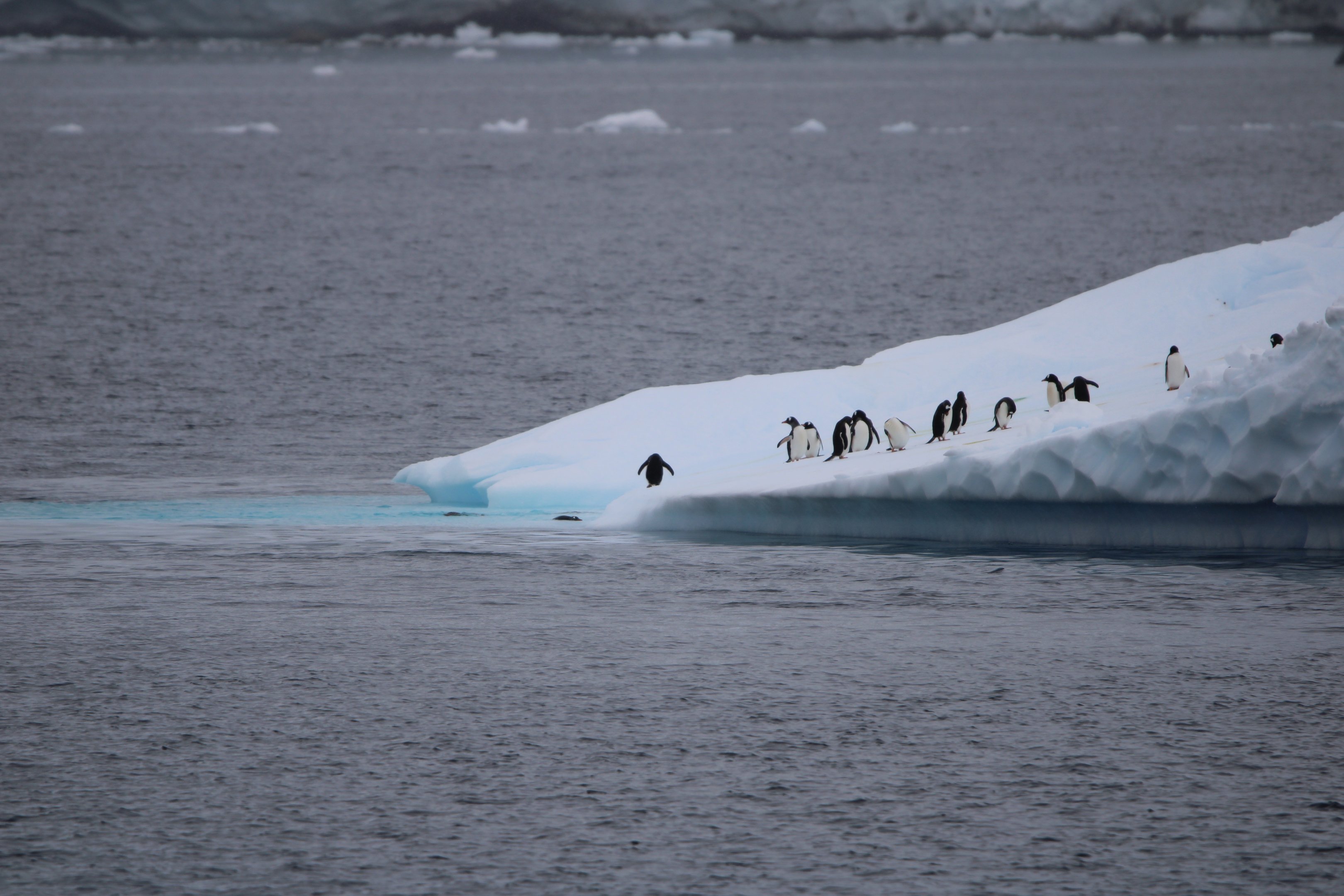
Having traversed the icy landscapes of the world's most remote continent, we have learned that technology can be your greatest ally in Antarctica. The days of relying solely on paper guides and traditional navigation tools are gone; today's Antarctic traveler comes prepared with a small digital toolkit that transforms the expedition experience.
The emphasis is on small. Try to minimize the apps you bring and carry only the ones you can see a real use for. A phone loaded with forty apps is just a heavier way to miss a whale.
For the practical side of the voyage itself — routes, ships, months and cost — start with our complete Antarctica guide.
Which app is best for Antarctic weather?
Windy. It provides real-time updates and detailed forecasts for the Drake Passage and the Peninsula, and on a crossing it can mean the difference between a comfortable journey and a challenging one.
The Drake Passage isn't for the faint of heart, but with Windy you can watch its unpredictable waters like a seasoned explorer. Swell height, wind speed and direction, updated continuously — this is the app the crew are watching too.
Download it before you sail and get used to reading it at home, so the charts mean something by the time you are looking at a nine-metre swell forecast. Our Drake Passage guide covers the crossing itself, including the fly-cruise alternative.
What are the best wildlife identification apps for Antarctica?
The Antarctic Wildlife Guide for the continent's animals, paired with Merlin Bird ID and eBird for its birds. Together they turn every sighting into an identification — you will know whether that penguin is an Adélie or a gentoo before it has finished looking at you.
Spotting a penguin and instantly knowing the species changes a landing. The Antarctic Wildlife Guide app makes that possible, and pairing it with Merlin Bird ID and eBird covers the continent's diverse avian population — petrels, skuas, albatross and the rest.
Log your sightings as you go and you come home with a proper record of the voyage rather than a camera roll of unidentified brown birds. Our Antarctica wildlife guide sets out what you can expect to see on the standard routes.
How does iNaturalist work in Antarctica?
You upload observations of flora and fauna, iNaturalist's artificial intelligence offers instant identification suggestions, and a network of expert naturalists and fellow enthusiasts reviews your findings to confirm or refine the species. Verified sightings become research-grade data points for scientists studying Antarctic biodiversity.
This is one of our favourite apps, and it is where the magic of the iNaturalist community comes alive. The collaborative verification process ensures the data is research-grade — meaning your casual sighting of a petrel becomes a valuable data point for scientists studying how Antarctic biodiversity is responding to a changing climate.
It is more than a digital diary; it is a direct connection to a worldwide effort to understand and protect one of the planet's most remote and fragile ecosystems.
Can travelers contribute to real science from a cruise ship?
Yes. Happy Whale lets you upload whale photographs, which scientists use to identify individual animals and track their movements. It is exploration with a purpose — a holiday sighting becomes a genuine scientific contribution.
One of the most exciting developments in Antarctic travel is the ability to contribute to research in real time. Photograph a humpback's tail fluke, upload it, and the Happy Whale team matches it against a global catalogue — often telling you where that individual whale has been seen before, sometimes thousands of miles away.
Several expedition operators run citizen-science programmes aboard, and the apps here are the traveler's half of that arrangement. Our citizen science guide sets out which programmes run on which ships.
Which apps help with the Southern Lights and night sky?
Aurora Forecast gives you the best chance of catching the elusive Southern Lights, and Skyview turns the crystal-clear Antarctic night into a personal planetarium for navigating the southern constellations.
The aurora australis is possible but never promised — most expedition voyages run in the near-continuous daylight of high summer, so treat any sighting as a bonus rather than an expectation. When the forecast and the darkness do align, Aurora Forecast is how you know to get on deck.
Skyview needs no solar activity at all. Point it at the sky and it names what you are looking at — the Southern Cross, the Magellanic Clouds, constellations northern-hemisphere travelers have never seen.
How do you track your ship in Antarctica?
Cruisemapper and Marine Tracker. They follow your vessel's position in real time, so you always know where your floating home is — and they identify the other ships you will occasionally pass in this remote region.
These apps provide peace of mind. From a Zodiac or a landing beach you can see exactly where the ship is holding, and back aboard you can put a name to the vessel on the horizon instead of guessing.
They are also simply enjoyable: watching your own track trace around the Peninsula over a voyage becomes a map of the trip you just made.
What are the pro tips for using apps in Antarctica?
Three rules cover almost everything: download before you sail, protect your battery from the cold, and treat offline as the default. Do those and the toolkit works; skip them and none of the apps matter.
Onboard WiFi can be as rare and precious as an emperor penguin sighting, so everything on this list — apps, maps, data packages, books — comes down the pipe at home, not at sea. Cold temperatures drain devices quickly, so portable chargers and battery-saving modes are not optional. And download every offline data package for the region before you leave civilization behind.
01
Download before you sail
Onboard WiFi can be as rare and precious as an emperor penguin sighting. Every app on this list should be installed, opened and updated while you still have real bandwidth.
02
Preserve your battery
Cold temperatures drain devices quickly. Bring portable chargers and use battery-saving modes whenever you are out on deck or ashore.
03
Download offline data and maps
Pull down all app data and maps before leaving civilization behind, including any region-specific packages the apps offer.
Should apps replace the actual experience?
No. These tools should enhance the expedition, not replace it. The whole point of Antarctica is the raw, untouched beauty of the world's last great wilderness — and no screen improves on that.
Take deliberate moments to put the device down. The toolkit exists so that when something extraordinary happens — a whale beside the Zodiac, light on an iceberg — you understand what you are looking at. The looking itself still has to be done with your own eyes.
Planning an expedition of your own?
Most Antarctic expeditions run between November and March. Technology has transformed polar exploration, making this once-impossible journey accessible to travelers from all walks of life — and choosing the right ship and month matters far more than any app.
These apps are your passport to understanding one of the most remarkable places on Earth, but they are the last ten percent of the planning. The first ninety is the voyage itself: the month, the route, the ship.
Our best time to visit Antarctica guide runs month by month, and our Antarctica cost guide sets out what a voyage costs and what sits outside the fare.
Apps and connectivity: common questions
Is there WiFi on Antarctic expedition ships?
Usually, but it is satellite-based and can be slow, intermittent and weather-dependent. Treat it as adequate for messaging at best, and download everything you need — apps, maps, books and data packages — before you leave home.
Which single app is most useful in Antarctica?
Windy, if you are crossing the Drake Passage — its real-time forecasts are what the crew watch too. For the landings themselves, the Antarctic Wildlife Guide paired with Merlin Bird ID and eBird adds the most to every day ashore.
Can my whale photos really help scientists?
Yes. Uploading whale photographs to Happy Whale lets researchers identify and track individual animals, and iNaturalist sightings verified by its expert community become research-grade data on Antarctic biodiversity.
Can you see the Southern Lights on an Antarctic cruise?
Occasionally, but most voyages run in near-continuous summer daylight, so treat the aurora australis as a bonus. Aurora Forecast tells you when conditions align; Skyview makes the rest of the southern night sky worth going on deck for.
Do I need dozens of apps for the trip?
No — the opposite. Minimize what you bring and carry only the apps you will genuinely use. A short, well-downloaded toolkit beats a phone full of apps that never get opened.
Does working with Glacial Expeditions cost more?
No. Our planning costs you nothing extra. Pricing matches booking direct with the cruise line, and Signature Travel Network amenities are added on top.
More Antarctica guides
Antarctica wildlife
Penguins, whales and seals, and how sightings shift across the season.
Citizen science on ice
The research programmes travelers can take part in, ship by ship.
Drake Passage: sail or fly
The crossing, the forecast, and the fly-cruise alternative.
Best time to visit Antarctica
November to March, and what each month gives you that the others do not.
Antarctica photography guide
Light, lenses and shooting icebergs from a moving Zodiac.
Antarctica packing list
What to bring — including the chargers your apps will depend on.