


Chilean fjords at a glance
- Where
- Strait of Magellan south to Cape Horn, southern Chile
- Typical voyage
- 4 to 5 nights, Ushuaia to Punta Arenas or reverse
- Signature stretch
- Glacier Alley, in the Beagle Channel's northwest arm
- Landings
- Pia Glacier, Ainsworth Bay, Wulaia Bay, Tucker Islets
- Season
- October to April
- Sea conditions
- Mostly sheltered channels rather than open ocean
- Our fee
- None. Pricing matches booking direct
What Are the Chilean Fjords?
A dense network of flooded glacial valleys running from the Strait of Magellan to Cape Horn, cut into the southern Andes and fed by tidewater glaciers off the Darwin Range. Almost none of it is reachable by road, so the region is cruised rather than toured, on voyages of four to five nights.
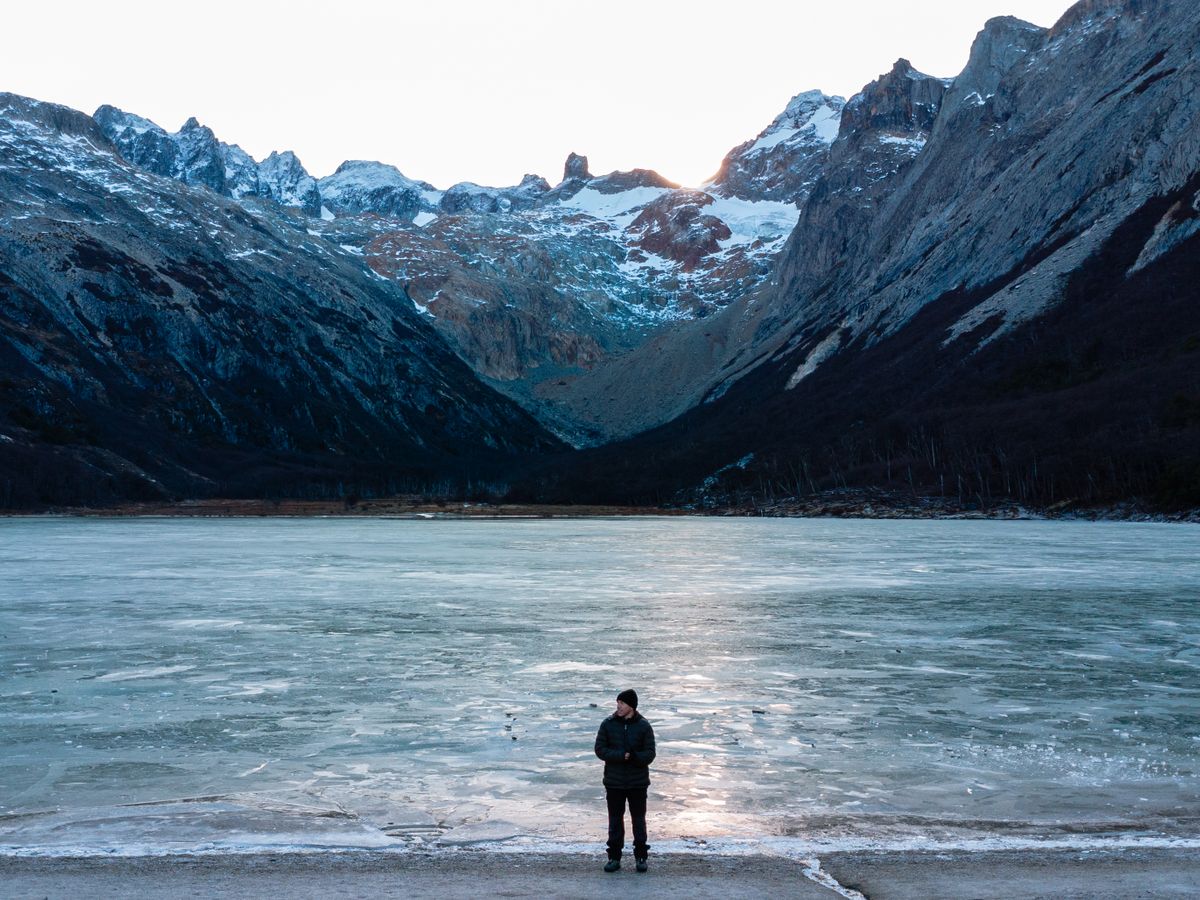
The geography is what makes the region work as a ship destination. Glaciers spilling off the Cordillera Darwin reach salt water at the head of narrow arms, and the ship sails to the ice rather than the other way round. Between the glacier arms lie sub-Antarctic beech forest, peat bog and bare granite, all of it within a few hundred metres of the waterline.
It is also genuinely remote in a way the map understates. Between Ushuaia and Punta Arenas you pass a handful of Chilean Navy posts, a few estancias and almost nothing else.
What Is Glacier Alley?
A stretch of the Beagle Channel's northwest arm where a run of tidewater glaciers descends toward the water in sequence, each named after a European country — Espana, Romanche, Italia, Francia, Alemania. Ships slow and turn broadside so both sides of the vessel see each one in turn, usually across a single morning.
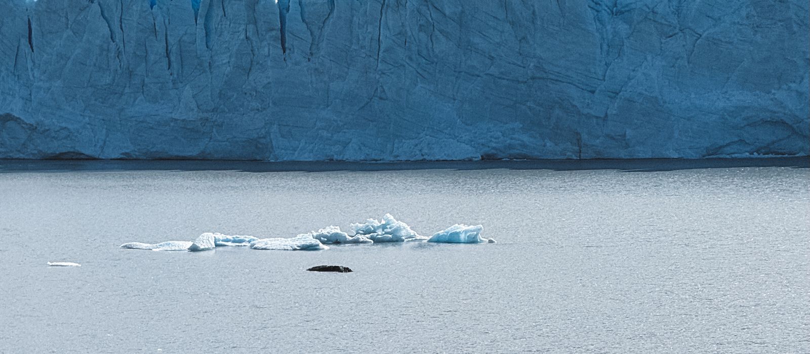
It is a scenic sail rather than a landing, and it depends on cloud base more than anything else. Low cloud hides the icefall and leaves you looking at the snout; a clear morning shows the whole cascade from the ridge down.
Glacier Alley is on the Chilean side of the channel. The eastern end of the Beagle, at Ushuaia, is a different experience entirely — day boats, sea lion colonies and the Les Eclaireurs lighthouse rather than glaciers.
Where Do Expedition Ships Actually Land?
Four sites recur on almost every itinerary: Pia Glacier in Alberto de Agostini National Park, Ainsworth Bay with its glacial moraine and elephant seals, Wulaia Bay for its Yamana history and forest walk, and the Tucker Islets for Magellanic penguins and imperial cormorants. Garibaldi Glacier is a Zodiac cruise through brash ice.
| Site | What happens there | Type of visit |
|---|---|---|
| Pia Glacier, Alberto de Agostini NP | Tidewater glacier off the Darwin Range; moraine walk to a viewpoint above the ice front | Zodiac landing and short hike |
| Glacier Alley, Beagle Channel | A run of tidewater glaciers named for European countries, viewed in sequence | Scenic sailing from deck |
| Ainsworth Bay | Wide bay backed by glacial moraine; tundra walk, beaver-worked streams, elephant seals | Zodiac landing and flat walk |
| Garibaldi Glacier | Blue ice wall in a narrow arm, approached through dense brash ice | Zodiac cruise |
| Wulaia Bay | Historic Yamana settlement site; forest walk to a ridge lookout | Zodiac landing and hike |
| Tucker Islets | Magellanic penguin and imperial cormorant breeding colonies, October to March | Zodiac cruise, no landing |
Every site is weather-dependent. Expect substitutions rather than a fixed itinerary.
Landings here are wet — you step off a Zodiac bow into shallow water in rubber boots — and the walks are short and steep rather than long. The Pia Glacier walk climbs a moraine ridge to a viewpoint above the ice front; Ainsworth is a flat tundra walk with beaver-dammed streams.
None of it is guaranteed. Wind decides, and a captain who cancels a landing at Pia will usually find another arm to work instead.
What Wildlife Will You See in the Fjords?
Southern elephant seals hauled out at Ainsworth Bay, Magellanic penguins and imperial cormorants breeding on the Tucker Islets from October to March, Andean condors on the ridge updrafts, and Commerson's and Peale's dolphins bow-riding in the channels. Southern sea lions are common throughout.
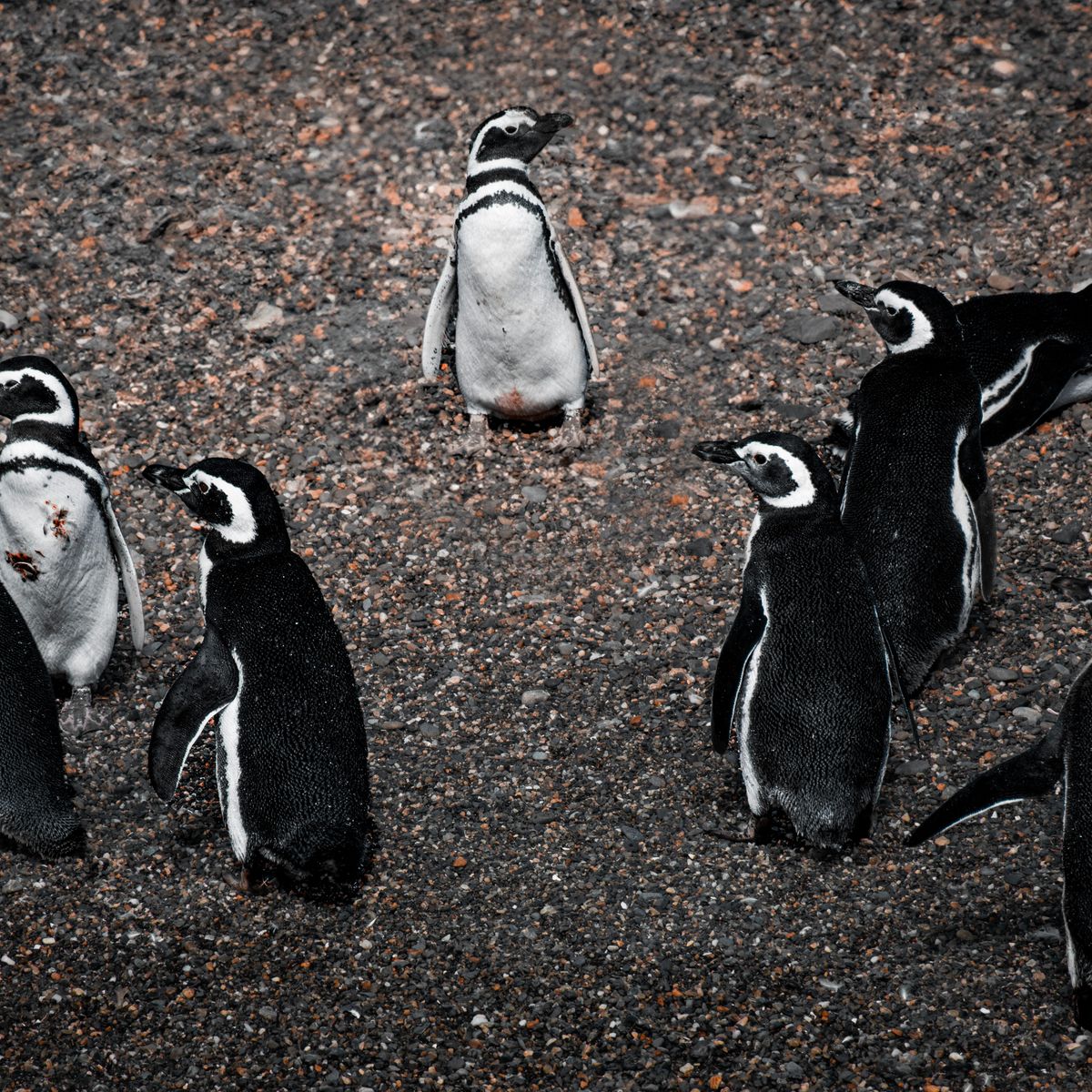
The Tucker Islets colony is large — several thousand breeding pairs of Magellanic penguins, which nest in burrows rather than on open ground. Ships cruise it by Zodiac rather than landing, so the birds are seen from the water.
Dolphins are the reliable pleasure. Peale's dolphins in particular will find a ship's bow wave and stay with it for a mile at a time.
Is the Sailing Rough?
Much less than people expect. Fjord itineraries spend most of their time inside sheltered channels, where mountains on both sides block the Southern Ocean swell and the water can be almost flat. The exposed sections are short: the run out toward Cape Horn and the open stretch of the Strait of Magellan.
This is the strongest argument for a fjord voyage if seasickness worries you. It is not the Drake Passage, and it is not comparable. Wind still matters, but wind in a channel produces chop rather than swell, and the ship is rarely far from shelter.
Which Ships Can Get In?
Only vessels with a shallow draft and their own Zodiac fleet. Purpose-built fjord expedition ships carrying roughly 160 to 210 guests dominate the region, alongside smaller luxury expedition vessels. Large ocean liners cannot enter the narrow arms at all and sail the outer route instead, which is a scenic cruise, not an expedition.
The distinction matters more here than in most destinations, because the good parts of this coast are physically inaccessible to a big hull. Patagonia cruise types compares the categories side by side, and Australis is the operator most associated with the four-night fjord route.
Have You Sailed the Chilean Fjords Yourselves?
No. Neither of us has sailed the Chilean fjords, Glacier Alley or Pia Glacier. We have been on the Beagle Channel at its eastern end, on a boat tour out of Ushuaia in December 2024 before boarding for Antarctica, which is the Argentine side and a different experience.
So the fjord detail on this page is advisor knowledge — operator itineraries, the published record and what our clients report back — rather than our own reporting. What we can speak to firsthand is the Ushuaia end: the town, the day boats, the sea lion colonies and the lighthouse at the channel mouth.
The full list of where we have and have not sailed is on where we've been. We would rather be plain about it than imply otherwise.
Chilean fjords questions
How long is a Chilean fjords cruise?
Most run four to five nights between Ushuaia and Punta Arenas in either direction. Longer voyages fold the fjords into a two- or three-week itinerary that continues to Antarctica.
What is Glacier Alley?
A stretch of the Beagle Channel's northwest arm lined with tidewater glaciers named after European countries, including Espana, Romanche, Italia and Francia. It is viewed from deck as the ship sails through, usually over a morning.
Are the Chilean fjords rough sailing?
Mostly no. Itineraries stay inside sheltered channels where mountains block the Southern Ocean swell, and only short sections near Cape Horn and in the Strait of Magellan are exposed.
Can a big cruise ship visit the Chilean fjords?
Not the fjords themselves. Large ships lack the draft and manoeuvrability for the narrow arms and sail the outer ocean route, so guests see distant scenery without landings.
When is the best time to cruise the Chilean fjords?
The season runs October to April. November and March bring lower winds and fewer visitors than the December to February peak.
More on Patagonia
Patagonia expedition cruises
The full picture: fjords, Cape Horn, wildlife and land extensions.
Cape Horn landings
The staircase, the albatross monument and why the landing is never certain.
Patagonia cruise types
Which vessels can reach the narrow arms, and which cannot.
When to cruise Patagonia
Wind, daylight and wildlife month by month.